Apps
Google Maps’ augmented reality feature goes live (for some)
It’s like Google Glass, only less dorky.
Just a heads up, if you buy something through our links, we may get a small share of the sale. It’s one of the ways we keep the lights on here. Click here for more.
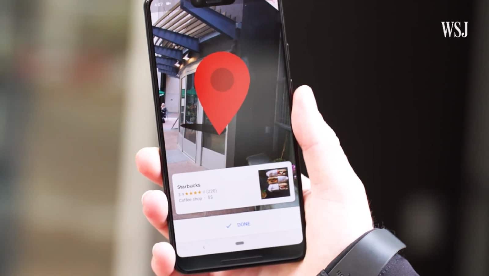
Last year, at its annual I/O developer conference, Google showed off a glimpse of what Google Maps could be. That included a new augmented reality feature which turns your phone into a heads-up display, like a low-rent Google Glass. Some users, like The Wall Street Journal‘s David Pierce, have been playing with the AR feature and it looks pretty cool so far.
It works like this: the app gets your rough location from your phone’s GPS module, then uses your camera and Google Street View data to narrow that down to your exact position. Once it pinpoints your location, it overlays huge arrows onto the view that your phone’s screen shows.
It’s like all those sci-fi flicks where people have smart contact lenses, or glasses, or windshields that show location-aware information as a world overlay – except it is science fact and it’s in your pocket.
This could be a nice feature for when you’re feeling a bit disorientated
Now, before you all rush to the comments section to call this a stupid idea, just know this isn’t likely to be your primary way of using Maps, at least not anytime soon. It’s designed for those disorientating moments, like when you step out of a subway station, where you don’t immediately know which way to go first. Take out Maps, point the camera up at the world, and it’ll show you the first steps. Then you can go back to using the regular Maps interface for the rest of your journey.
With the feature still being in preview, expect UI and other things to change as Google gathers more feedback. So far, Google has realized that users would follow a line on the ground far too closely, likely bumping into things, and having the guide animated kept users glued to the screen.
With Google needing to strike a balance between usability and safety, it’s an interesting UI challenge. How much information do you give the user? How long do you display it, and how do you lessen the impact of distraction. These and more will have to be addressed before the feature rolls out to the general public.
I could see this having a firm home in cars, where the AR feature would be right at home on your windshield. Until then, I’ll stick to the tried and tested map view.
What do you think? Does this look like a feature you’d use? Let us know down below in the comments or carry the discussion over to our Twitter or Facebook.
Editors’ Recommendations:
- Google is finally giving Chrome an official dark mode
- Google Maps will now show you upcoming speed traps
- You can now download an update to fix Apple’s FaceTime bug
- Your Android phone could be compromised by a simple image
- Here’s how to use the unsend feature in Facebook Messenger


